GulfSCEI Capabilities
Compute Capabilities
GulfSCEI Servers:
GulfSCEI-USACE is a cutting-edge server setup, a testament to our commitment to harnessing the power of advanced technology. Our server is powered by the AMD EPYC™ 7713 processor, a beast of a CPU with 64 cores and 128 threads, capable of handling the most demanding workloads with ease. Complementing this is a massive 1 TB of RAM and four NVIDIA A100 GPUs, each with 80 GB of dedicated VRAM. These GPUs are not just about raw power; they're about versatility, supporting a wide range of data types and workloads, and offering up to 624 TFLOPS of performance with Tensor Cores. Our server is connected to an HPE MSA 2060 Large Form Factor storage system via a dedicated SAS link, operating at a high-speed of 12 Gb/s. This ensures rapid data retrieval and transfer between the server and the storage system, which boasts a substantial capacity of 300 TB.
- AMD EPYC™ 7713 with 64 cores
- 1 TB of RAM
- 4x Nvidia A100 GPUs w/ 320 GB total VRAM
- 12 Gb/s SAS link to 300 TB storage system
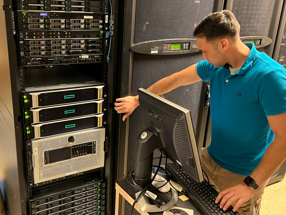
USACE-HYPERVISOR is engineered as a collaborative compute hub, balancing raw power with intelligent resource management. At its core, it runs on the AMD EPYC™ 9454, a 48-core, 96-thread processor clocked at 2.75 GHz, providing the throughput necessary for concurrent users and demanding workloads. This is paired with an immense 1.5 TB of RAM, ensuring that memory-heavy workloads can run side-by-side without contention. What sets this system apart is its integration of four NVIDIA H100 Tensor Core GPUs. With their performance for training, inference, and scientific workloads, the H100s are shared seamlessly among users through a job queue system and JupyterHub interface. This ensures that researchers, engineers, and data scientists can submit tasks, experiment interactively, and utilize GPU power without stepping on each other’s toes — maximizing both productivity and fairness across teams. Built on the resilient HPE ProLiant DL385 Gen11 platform and running XCP-ng virtualization, the system supports dozens of VMs and containers while maintaining months of uninterrupted uptime. It’s the perfect balance of high-performance compute, virtualization stability, and multi-user accessibility, making it a cornerstone resource for advanced research and development.
- AMD EPYC™ 9454, 48 cores / 96 threads @ 2.75 GHz
- 1.5 TB RAM
- 4× NVIDIA H100 Tensor Core GPUs
- Platform: HPE ProLiant DL385 Gen11 on XCP-ng
- Features: JupyterHub front-end with job scheduling for shared GPU access
- Workloads: Multi-tenant research, AI/ML model training, storage and orchestration
GulfSCEI-LINUX is a veritable titan of computational power, boasting the formidable Intel Xeon E5-2630 v3 processor at its heart. With 8 cores, 16 threads, and a turbo boost frequency of up to 3.20 GHz, this server effortlessly handles even the most demanding workloads. Coupled with an astounding 240 GB of RAM, it ensures seamless operation and swift data access, eliminating bottlenecks and enhancing overall performance. But the true marvel lies in its storage capacity. With a staggering 32 TB of local storage, it stands ready to accommodate vast databases, high-definition multimedia, and extensive archives with ease.
- Intel Xeon E5-2630 v3 @ 2.40GHz with 8 cores (16 threads)
- 240 GB RAM
- 32 TB local storage
GulfSCEI Workstations:
At GulfSCEI, we are proud to equip our researchers with the performant Dell Precision 5820 Tower workstations. These machines are powered by the formidable Intel Core i9-10900X processor, which, with its 10 cores, Hyper-Threading technology, and a turbo boost frequency of up to 4.7GHz, ensures exceptional computational performance. The workstations are further enhanced with 32 GB of DDR4 memory, providing ample space for complex datasets and ensuring smooth multitasking. For graphics-intensive tasks, these workstations boast the powerful Nvidia GeForce RTX 3080Ti graphics card, delivering unparalleled visual performance. Storage is no less impressive, with a lightning-fast 512 GB M.2 PCIe NVMe Class 40 Solid State Drive ensuring swift data access and efficient operations. Running on the reliable and secure Ubuntu Linux 20.04, these workstations offer an optimal environment for research and development. In essence, our researchers are equipped with the best-in-class technology, enabling them to push the boundaries of innovation and discovery.
- Intel Core i9-10900X processor
- 32 GB of DDR4 memory
- Nvidia GeForce RTX 3080Ti graphics card
- 512 GB M.2 PCIe NVMe Class 40 Solid State Drive
- Ubuntu Linux 20.04
GulfSCEI Robotics
Jackal Robot:
The GulfSCEI center utilizes the Clearpath Robotics Jackal ground vehicle. Jackal is a rugged, lightweight, fast, and easy-to-use unmanned ground vehicle for ROS Noetic designed to conquer diverse terrains and tasks with unparalleled precision and agility. At its core lies a 270-watt-hour lithium battery, providing ample power for extended missions. Whether navigating rugged outdoor landscapes or maneuvering through indoor environments, Jackal’s robust energy source ensures sustained performance and endurance. Controlled by a Sony Bluetooth controller, the Jackal offers seamless remote operation, enabling intuitive control and real-time interaction with the environment.
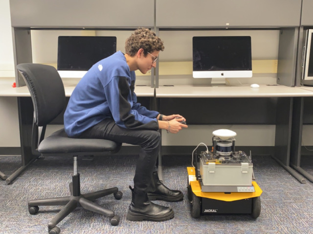
Jackal integrates the Velodyne VLP16 LIDAR, delivering unparalleled 360-degree environmental sensing capabilities. With its high-resolution laser scanning, the Jackal effortlessly maps its surroundings, enabling obstacle detection and navigation in dynamic environments with high accuracy and efficiency. It features an Axis PTZ Camera, providing high-definition imagery for enhanced situational awareness and surveillance capabilities. The Jackal is also equipped with SwiftNav GPS technology, ensuring precise localization and navigation capabilities across diverse environments.
Driving its computational power is the NVIDIA Jetson AGX Orin, a cutting-edge AI computing platform that powers the Jackal’s advanced autonomy and decision-making capabilities. With its high-performance computing architecture, the Jetson AGX Orin enables real-time data processing, machine learning, and autonomous decision-making, empowering the Jackal to adapt and respond intelligently to dynamic environments and evolving mission requirements.
Drone Capabilities
The GulfSCEI Center utilizes the senseFly eBee+ and eBee TAC fixed-wing sUAS systems, some of the best drones on the market for high-resolution aerial photography. We also have access to traditional platforms such as the DJI Mavic 2 Pro for quadcopter operations.

All fixed-wing flights are digitally-planned, using the latest eMotion software suite. This means our flights can be conducted in any environment, so long as adequate takeoff and landing vectors are available. The flight-path is adjusted in-software to provide ideal routes and optimal imagery for each mission. A lower flight altitude can be used for better ground sampling distance for critical areas of observation.
Using Pix4D software, extremely accurate mosaics and 3D point clouds are generated for the entire survey area from GPS location, depth inference, and feature detection. Each pixel of these mosaics may be aggregated from upwards of 4 to 5 different raw images. These mosaics are fully orthonormalized to correct distortion and the resulting images are suitable for making high-precision measurements.
The GulfSCEI’s robust data center is equipped to process these images and perform a variety of post-processing, machine learning, and predictive tasks. All GulfSCEI pilots are sUAS-rated airmen certified under FAA 107.
Specifications for each of our drones are listed below:
| senseFly (AgEagle) eBee TAC Black | ||
|---|---|---|
|
||
| Payload | Capabilities | |
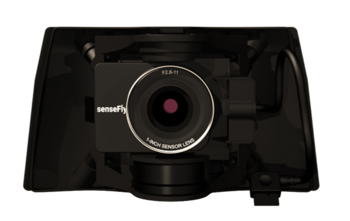
senseFly S.O.D.A. 3D
|
|
|
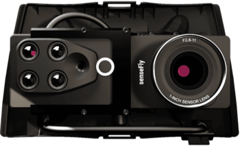
senseFly Duet M
|
RGB |
|
| Multispectral |
|
|
senseFly Duet T
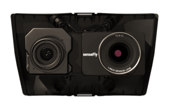
|
RGB |
|
| Thermal |
|
|
| senseFly (AgEagle) eBee+ | ||
|---|---|---|
|
||
| Payload | Capabilities | |
senseFly S.O.D.A.
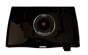
|
|
|
senseFly ThermoMAP
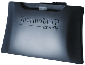
|
|
|
Parrot Sequoia
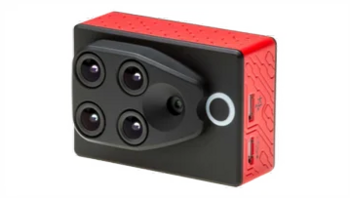
|
RGB |
|
| Multispectral |
|
|
| DJI Mavic 2 Pro | ||
|---|---|---|
|
||
| Payload | Capabilities | |
| RGB Camera |
|
|

